Hiking in Torres del Paine – Chile
Tens of thousands of people visit Torres del Paine National Park each year and many of them are attracted by the chance to hike through some of the most epic scenery in Chile. There are trails for all types of hikers in Torres del Paine (both inside and outside the park) and we did as many hikes as possible. Rely on our guide to hiking in Torres del Paine for details about these 13 trail options including superstars like the W Circuit and Base de Torres.
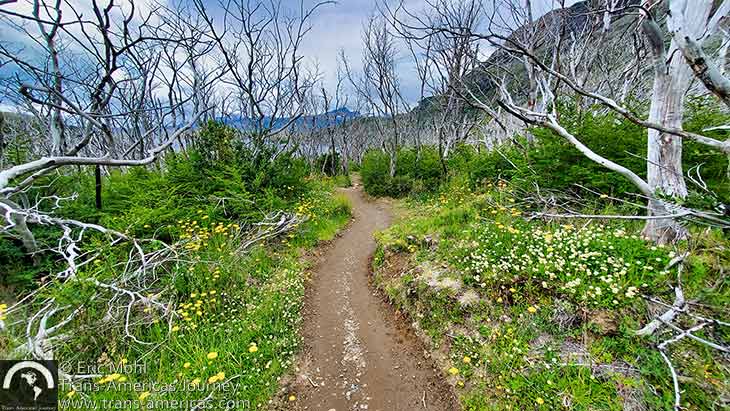
Another lovely trail in Torres del Paine National Park.

Hiking in Torres del Paine
We clocked about 100 miles (161 km) on 13 different trails during three visits to the Torres del Paine region. While a guide is not necessary on many of the trails in this post, we have noted when and where guides are required or recommended. Some trails inside the park have entrance cut-off times after which hikers can’t set off (as noted). Whatever trails you choose, remember that this is serious hiking in a remote location with changeable weather and often challenging terrain.
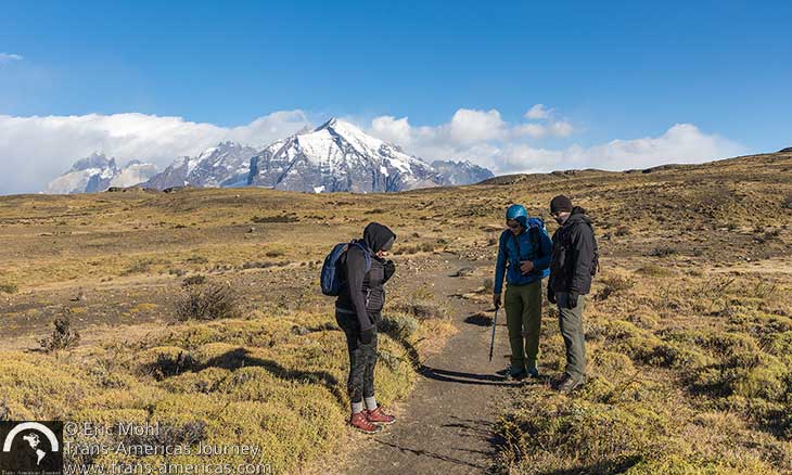
A popular hiking trail within Torres del Paine National Park is also popular with pumas. Here, hikers on the Anonikenk Trail examine fresh paw prints.
Here’s more about hiking in Torres del Paine. Download the official Torres del Paine National Park map to see roads and trails within the park along with trail distances and estimated hiking times of the trails on the O and W Circuits.
The O Circuit and W Circuit hikes in Torres del Paine National Park
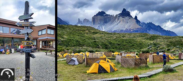
Camping and lodge facilities at Refugio Paine Grande which is one of nine campgrounds available to hiker doing the W Circuit or the O Circuit.
Although no permit is required for either of these multi-day hikes, prior planning is a must since hikers are required to have a campground reservation for each night of their trek (no walk-ups). Space is limited in the campgrounds on these circuits and reservations book up fast and can be very hard to get during the high season. Reserve early.
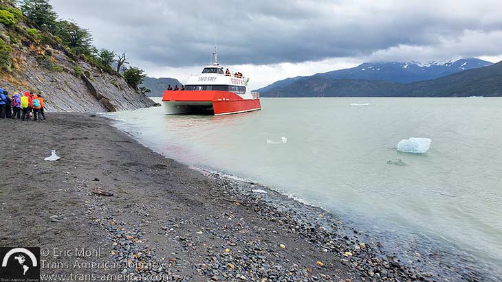
The Grey Glacier tourist boat landing at the beach below Refugio Grey.
The W Circuit can be done in either direction, beginning at Hotel Las Torres and ending at Refugio Grey, or vice versa. Either way, the W Circuit requires you to begin or end the trek with a pricey (nearly US$100) one-way trip on the Grey Glacier tourist boat that connects the beach landing just below Refugio Grey to the rest of the park. This boat often requires advanced reservations.
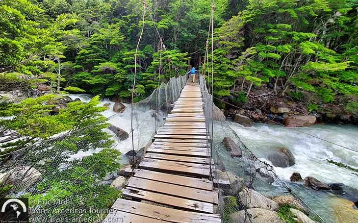
Karen crossing a hanging bridge along the French Valley Trail.
The W Circuit Trails
We didn’t do the W Circuit as a multi-day hike. Instead, we completed much of “The W” (as most people call it) by making day hikes out of its main components which are: the Grey Glacier Trail (which forms the western/left arm of the W), The French Valley Trail (which forms the middle arm of the W), and the Base de Torres Trail (which forms the eastern/right arm of the W).
To access the Grey Glacier Trail or the French Valley Trail as a day hike, it’s necessary to take a ferry both in and out so your time on the trail will be constrained by the limited ferry schedule.
The Base de Torres Trail
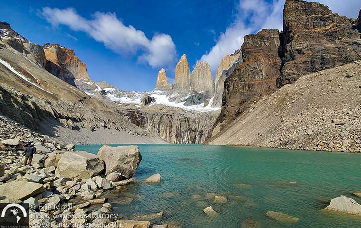
Views like this are your reward at the end of the iconic Base de Torres Trail.
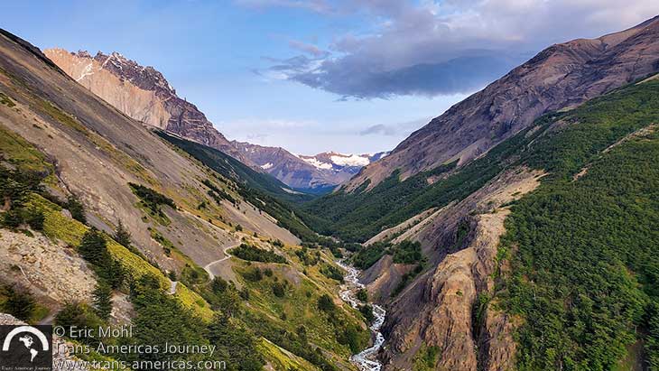
This view of steep valleys and snowy peaks is from a spot called Windy Pass on the Base de Torres Trail.
Once you’re through the rocky section you arrive at the end of the line. Pick a spot in overlooking the glacial lake at the foot of the towers formation and enjoy the view. You’ve earned it. This is the perfect place to refuel before the descent back down the same trail you just ascended.
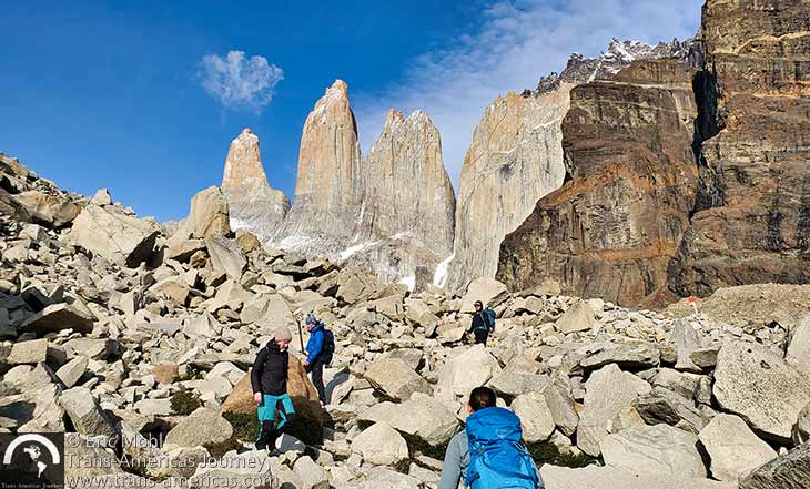
The final mile of the Base de Torres Trail is a doozy…
Pro trail tips: This trail is so popular that park officials have had to recognize that trail traffic is both dangerous and unpleasant. We have heard that park officials are exploring ways to manage trail use in high season such as capping the number of hikers at just a few thousand per day. One thing you can do to beat the crowds is get on the trail as early as possible. We did the Base de Torres Trail while staying at the Awasi Patagonia lodge where all guests get a private guide. We were able to coordinate with our guide so that we could arrive at the trailhead at 6 am–at least two hours earlier than the start time for most other hikers. This ensured that we didn’t encounter hordes of hikers until we were back down at Chileno Camp well on our way out. All hikers must reach Chileno Camp before 3:45 pm or you won’t be allowed to go any further. In icy or snowy conditions, park rangers may require that hikers carry and use crampons and trekking poles for the final push to the end of the trail. And concessionaires rent horses to carry people and goods to and from Chileno Camp, so you may have to share lower parts of this trail with pack animals. This trail is a popular classic, but don’t underestimate it. Wear layers and sunscreen, bring lots of water and snacks, start early, and remember that good boots are required and poles are highly recommended.
The French Valley Trail
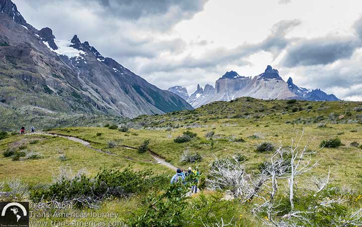
Heading out on the French Valley Trail in Torres del Paine National Park.
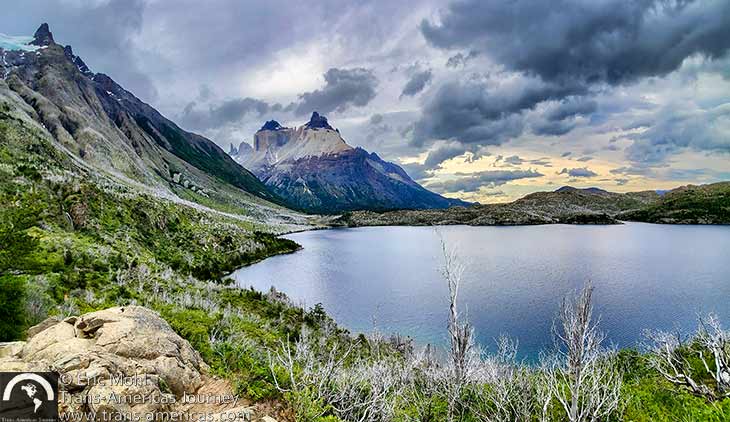
Skottsberg Lake and views of the Cuernos formation along the French Valley Trail.
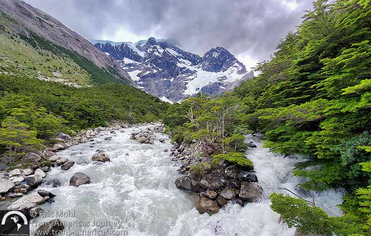
Hikers on the French Valley Trail will see plenty of snow, ice, and water.
Pro trail tip: To do the French Valley Trail as a day hike, remember that you will have to follow the limited schedule of the public ferry across Lago Pehoe which only runs a few times a day. You’ll also need to reserve your passage on the ferry. If you are not a fast hiker, you likely will not have time to walk all the way to the British Lookout and get back down the trail in time to catch the last ferry of the day.
The Grey Glacier Trail
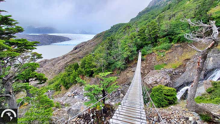
Views of Grey Glacier make it worth the extra effort to hike beyond Refugio Grey to the hanging bridges on the Grey Glacier Trail.
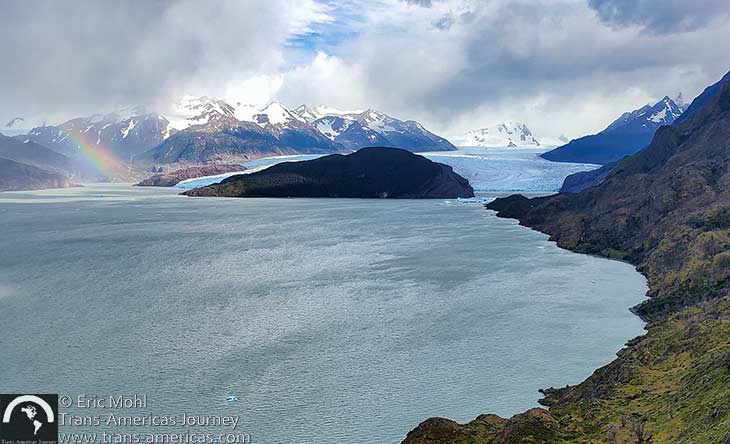
Grey Lake and Grey Glacier in the distance, as seen from the Grey Glacier Trail in Torres del Paine National Park.
Day hikers and those doing The W are not permitted to continue past the viewpoint. That section of trail is only open to O Circut hikers. Day hikers backtrack from the viewpoint to Refugio Grey. From there, the only way out is a one-way trip on the pricey (nearly $100) Grey Glacier tourist boat which departs from the beach landing below Refugio Grey and takes passengers across Lago Grey to Grey Beach near the Hotel Lago Grey in the western sector of the park. After getting off the boat, passengers walk across Grey Beach and back to the parking lot (1.2 miles/1.9 km).
Theoretically, the Grey Glacier Trail could be done in reverse, starting from Hotel Lago Grey and ending at the Lago Pehoe ferry. However, in that direction hikers don’t have the luxury of ending the hike with the trail extension to the Grey Glacier Lookout as this reverse routing makes it harder to judge your timing and ability to reach the Lago Pehoe ferry dock in time to catch the last ferry across Lago Pehoe.
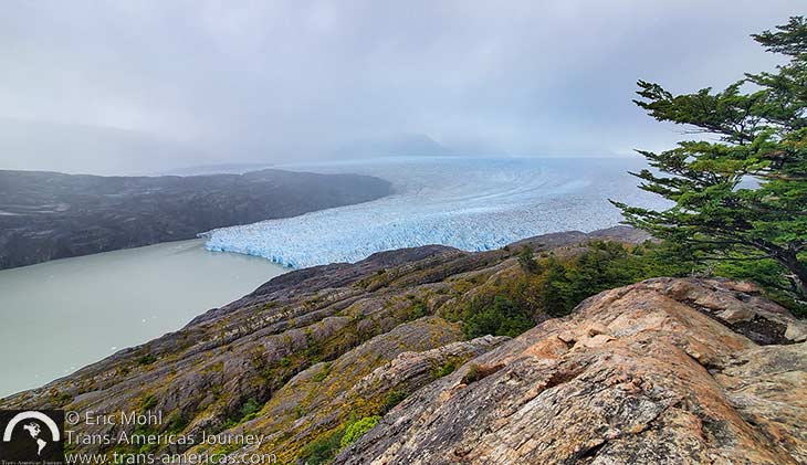
Grey Glacier.
Other challenging hiking in Torres del Paine
Hikers hoping to push themselves on the trail will find many ways to do that above and beyond The W Circuit and the O Circuit. We did more than our fair share of hard hiking in and around Torres del Paine National Park and it was worth every steep and sweaty mile.
The Cerro Obelisco Trail
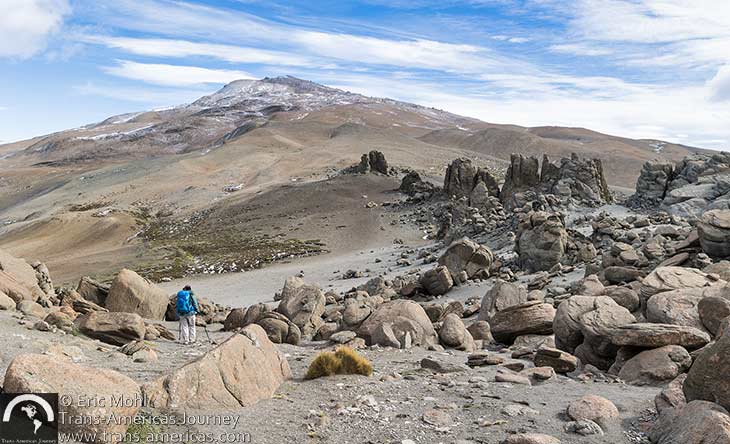
Hikers on the Cerro Obelisco Trail–located just outside the national park–will see otherworldly landscapes and maybe even puma prints….but they probably won’t see any other people.
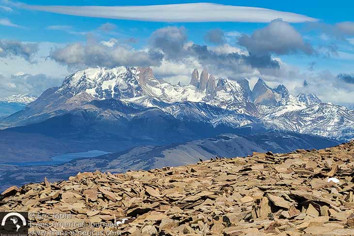
Views of the Torres del Paine three towers formation on the way up the Cerro Obelisco Trail.
On the way to the summit, we got a unique view of the towers formation (which gives Torres del Paine National Park its name) from slightly above, which gave us the unique vantage point of looking down on the Paine Massif. We descended in a nearly straight steep line. Allow at least 6 hours to complete this challenging trail and be prepared for long steep sections.
Pro trail tip: The Cerro Obelisko trail is on the Estancia Cerro Guido sheep ranch and, as of this writing, only guests of Hotel Cerro Guido and guests of the nearby Tierra Patagonia Lodge & Spa were allowed onto the trail and only with a guide.
The Cerro Castillo Trail
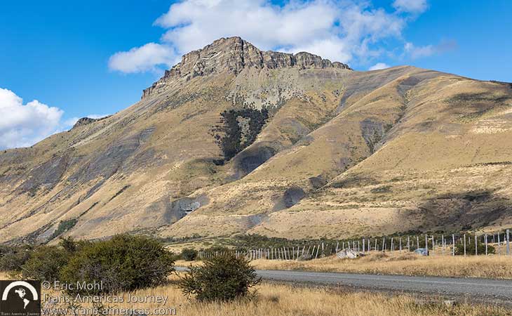
This view of Cerro Castillo was our first hint that this was going to be one steep hike…

Approaching the rock escarpment at the top of Cerro Castillo.
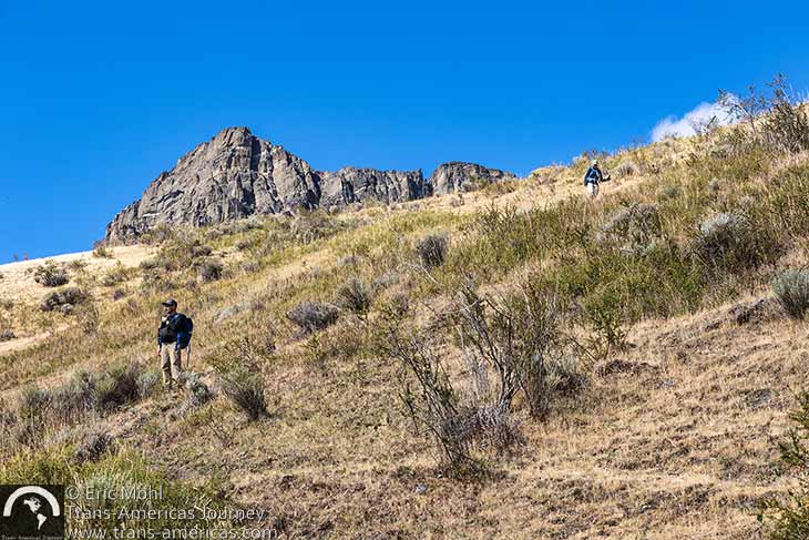
Somehow, going back down the steep and trailess terrain was even harder than going up.
Get a sense of the steepness–and a look at some of those condors–in our video from the Cerro Castillo Trail, below.
Pro trail tip: If ever there was a trail that required hiking poles, this is it. Cerro Castillo is on private Estancia Property, but jumping the fence doesn’t seem to be an issue.
Moderate hiking in Torres del Paine
You can’t spend all of your trail time pushing it to the max. Luckily, visitors will also find a wide range of moderate trails in Torres del Paine, each offering an enjoyable amount of exertion out in nature.
The Aonikenk Trail
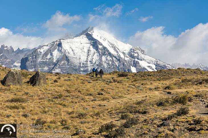
Grasslands, snowy peaks, ancient cave art, and maybe even pumas are highlights of the Aonikenk Trail in Torres del Paine National Park.
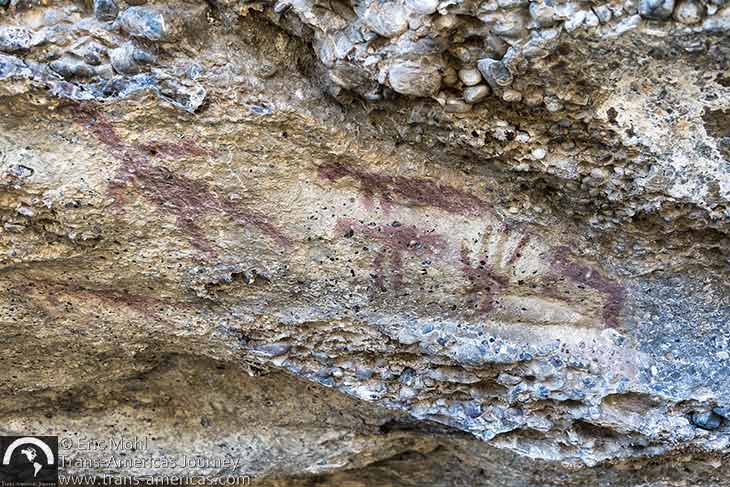
Thousands of years ago, members of the Aonikenk culture left their mark in a cave that is visited by hikers on the Aonikenk Trail.
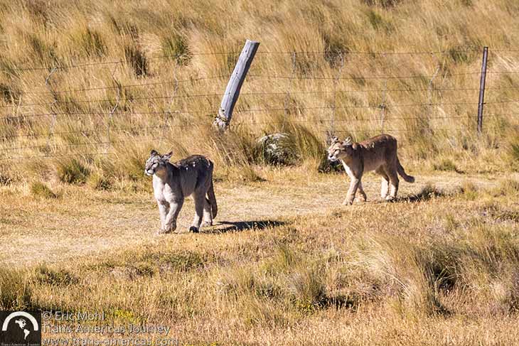
Pumas are increasingly commonly spotted on the Aonikenk Trail. When we hiked it, we nearly walked over a female and her two cubs (pictured above) as they napped in the tall grass. The female puma is seen here so frequently that she has been named Rupestre, which means rock painting in Spanish.
Pro trail tip: This one-way trail starts at the Lago Sarmiento park entrance and ends at the Laguna Armarga park entrance and, as noted above, this trail must be done with a guide who should have a vehicle and a driver to handle drop off and pick up.
The Toro Lake Mirador Trail
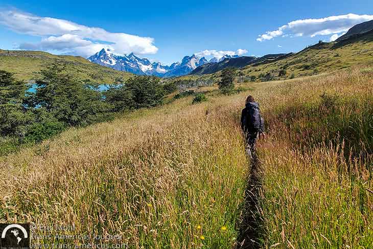
On the Toro Lake Mirador Trail.
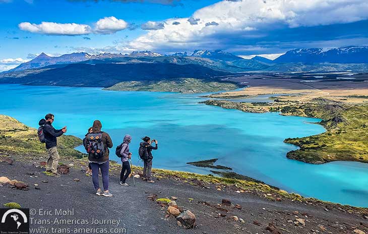
A windy viewpoint over Toro Lake.
The Ferrier Viewpoint Trail
The Ferrier Viewpoint Trail starts in the western area of Torres del Paine National Park close to Hotel Lago Grey. We planned to hike this trail, named for the man who donated this chunk of land to the national park, as our second hike of the day (after the nearby Pingo Waterfall Trail, see below). However, our plans were thwarted because this in-and-back trail has a strict entry cut-off time. We were unaware of this restriction and because of our late arrival to the trailhead, park rangers would not let us head up.
We’re told that portions of the 4.2 mile (6.7 km) Ferrier Viewpoint Trail, which climbs nearly 2,000 feet (610 meters), are quite steep before hikers reach a lookout point with spectacular 360-degree views of lakes and parts of the Southern Patagonian Icefield. Allow at least three hours round trip at a strong pace (2 hours up, 1 hour back down).
Pro trail tip: Get an early start to ensure you arrive at the trailhead before the trail cut-off time which varies by season.
The Pingo Waterfall Trail
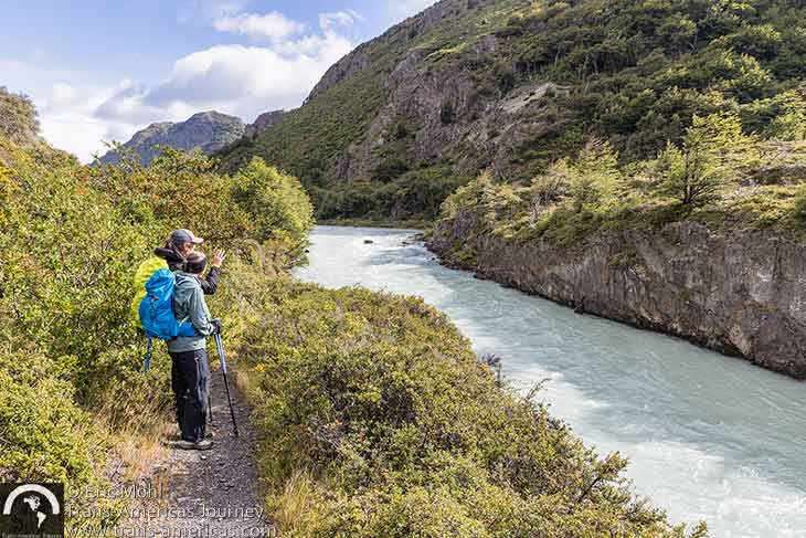
A portion of the Pingo Waterfall Trail in Torres del Paine National Park hugs the Pingo River.
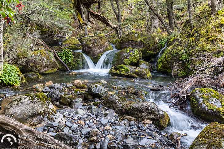
A charming small falls just below the main Pingo Waterfall.
Pro trail tip: The Pingo Waterfall Trail continues for many more miles beyond Pingo Waterfall to reach the highest waterfall in the park and the Zapata Mirador along a trail that climbs steeply at the end to reach the falls. This full route is usually done in two days.
Easy hiking in Torres del Paine
The challenging and multi-day hikes in the Torres del Paine region get most of the spotlight. However, there are some relatively easy hikes in Torres del Paine National Park. Here are some short and friendly trails that are more suitable for visitors looking for a stroll and for visitors hiking with children.
The Condor Viewpoint Trail
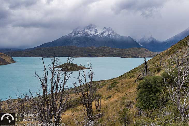
Hiking up to the Condor Viewpoint Trail in Torres del Paine National Park moments before the skies opened up. Again.
Pro trail tip: The Condor Viewpoint Trail is usually done as a one-way trail up to the viewpoint, then down the other side of the hill. If you’re in your own vehicle you may want to climb up to the viewpoint and then backtrack back down and out to your vehicle.
The Cuernos Viewpoint Trail
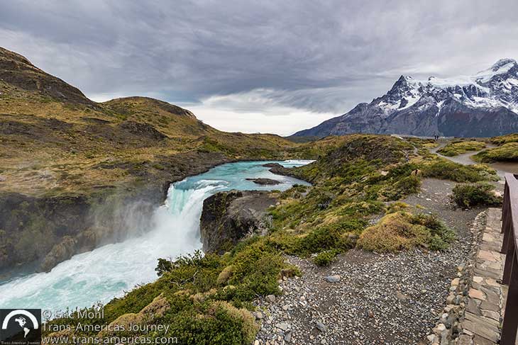
Salto Grande (salto means waterfall in Spanish) is the first scenic stop on the Cuernos Viewpoint Trail in Torres del Paine National Park.

The Cuernos Viewpoint Trail in Torres del Paine National Park ends with, you guessed it, views of the Cuernos (horns) formations on the right side.
Pro trail tip: Park officials may close this trail in high wind conditions.
The Laguna Azul Trail
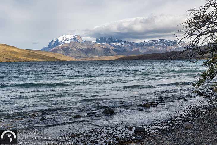
Lovely Laguna Azul with the three spires of the torres (towers) formation under clouds in the background.
Pro trail tip: Visitors who like rocks and stones will enjoy “beach coming” for some true beauties along the shore of Lago Azul.
The Grey Beach & Grey Glacier Lookout Trail
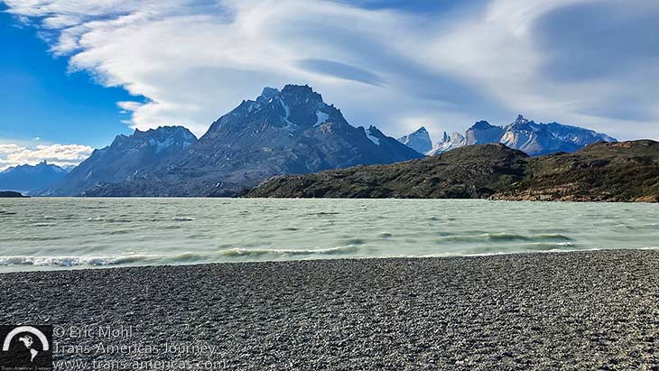
This easy hike in Torres del Paine National Park begins with a stroll over rocky Grey Beach.
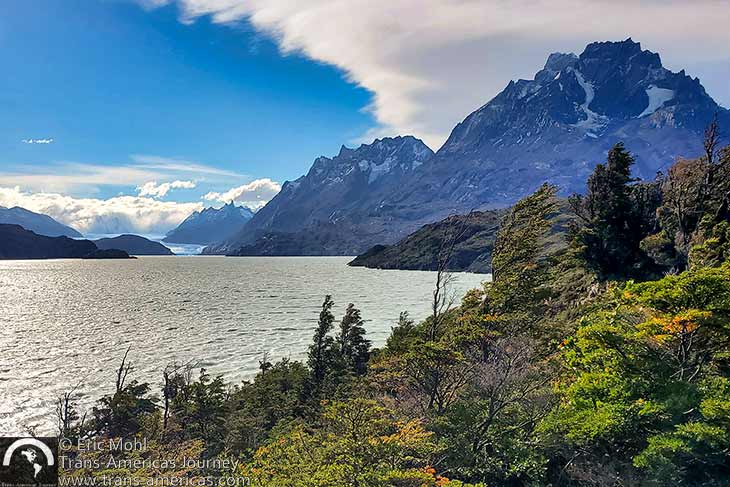
Grey Glacier in the distance, as seen from a lookout point on the easy trail around a low outcrop on Grey Lake.
Pro trail tip: If you don’t have the time or the budget for the Grey Glacier boat trip, this quick hike delivers a good view of Grey Glacier.
Our map, below, shows the location of trails and hotels in and around Torres del Paine National Park that were covered in this post.
Top gear for hiking in Torres del Paine
We recommend good hiking boots (that you’ve already broken in) on all trails (yes, even the moderate and easy ones). We also highly recommend hiking poles. Trail conditions can be wet and/or muddy so boot gaitors are a good idea too. Ample day packs with a built-in water bladder (we’ve been hiking with our women’s Sirius 36 and men’s Stratos 36 Osprey backpacks since 2018 and we still love them) are also a good idea to ensure you’re carrying the sunscreen, layers, and snacks required along with easy-access water to keep you hydrated. And speaking of layers, always bring gear for hot, cold, windy, and wet conditions since the weather is fickle in Torres del Paine.
Here’s more about travel in Chile
Here’s more about Hiking in the Americas
Here’s more about Adventure Travel in the Americas
Here’s more about National Parks in the Americas